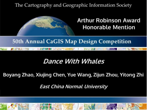
The printed map work Dance with Whales was co-produced by five undergraduate students, including Zhao Boyang, Chen Xiujing, Wang Yue, Zhou Zijun and Zhi Yitong from the School of Geographic Sciences at ECNU. The printed map also has been awarded the 2022 “Arthur Robinson Award for Best Printed Map” Honorable Mention Award for its outstanding design quality.
In 2022, the award issued one Winner and four Honorable Mentions. This is the first time for students from ECNU’s School of Geographic Sciences to win the award for this international cartographic competition. The participating team is also the only student team to win the award as a Chinese institution in the past 18 years.
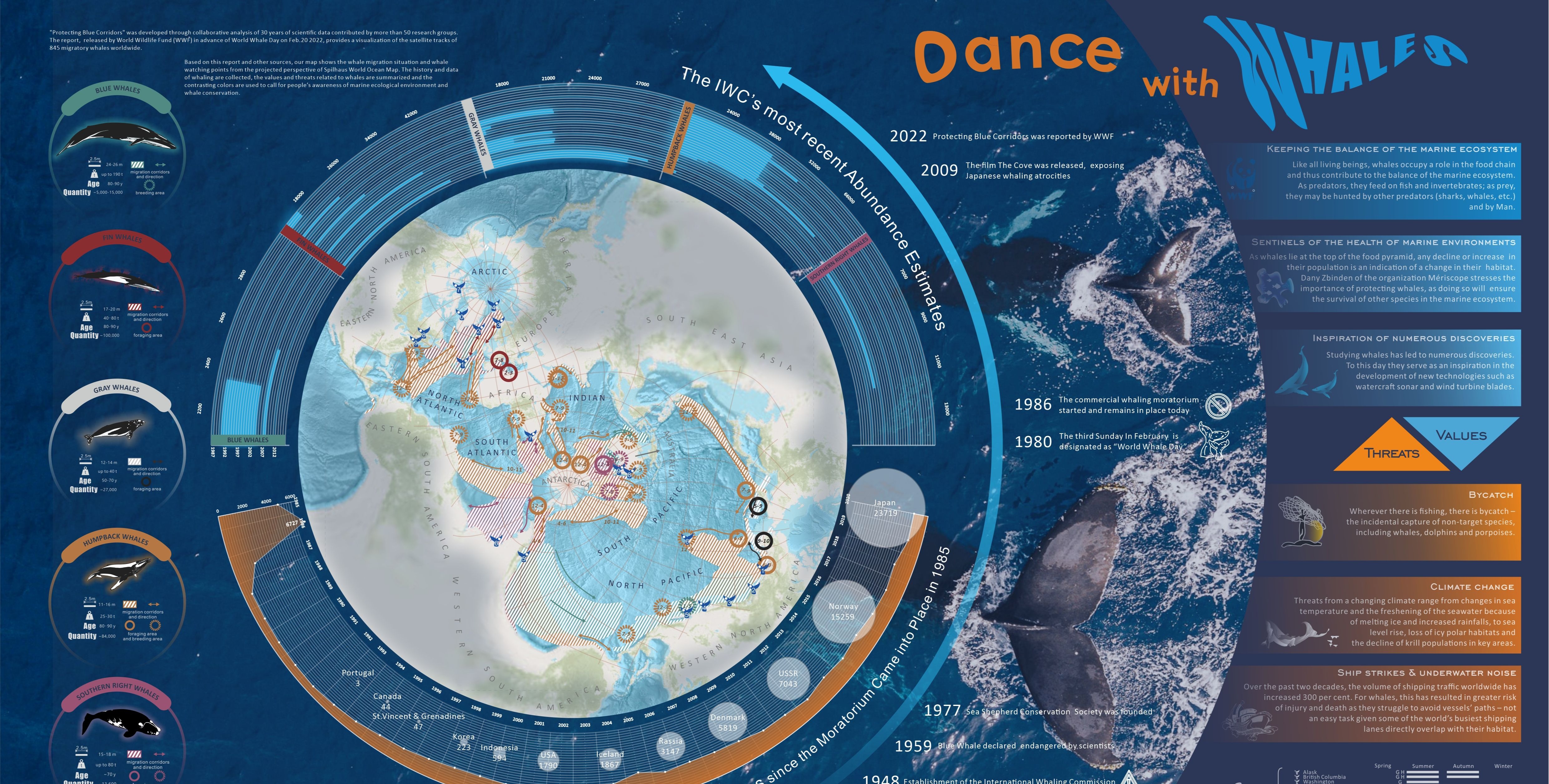
From capturing carbon to boosting ocean productivity, whales function as sentinels for ocean health and climate stability. Along with the human’s ocean exploitation and global climate change, these species of whales are confronted with a great threat since one-third of the world’s whales are listed as endangered by the International Union for Conservation of Nature (IUCN).
To determine the most important habitat and migration route of whales, while promoting and displaying effective science popularization models, are important ways to improve the human awareness to protect the blue corridors. Protecting the blue corridors include the migration areas of whales. Upholding the purpose of marine ecological protection, the team members identified the theme of the work——“Dance with Whales.” Faced with a lack of data in the early stages of development, the team members turned to focus on international organizations and reports to conduct their analysis on the research project.

The Protecting Blue Corridors released by World Wildlife Fund (WWF) in 2022 provides abundant information in a timely manner. The report combines satellite-tracking data from more than 50 research teams, of whom are conducting research on 845 migrating whales around the world, with over 30 years of experience to show the global patterns of the whales’ blue corridors.
On the basis of this report, the team applied their geographical expertise to categorize the models, such as reorganizing the whale’s five migration routes, adjusting to the whale-watching seasons and the historical statistics related to whaling, and sorting out the ecological value of whales and the main existential threats they face combined with the ecological risk factors.
Faced with the difficulties of integration and effective communication, the multi-dimensional and complex spatio-temporal thematic information obtained from the research project allowed the team to boldly adopt the Spilhaus world ocean projection results. The results from the main framework were based on the GeoInfographics pattern, of which the visual conflict was established through a two-color scheme of metaphorical references to “threat” and “protection”. The overall narrative of the research project was guided by the visual hierarchy of concentric circles, clearly presenting the ecological map of the earth from the perspective of a new cetacean.
According to the CaGIS website, the winning entries will be displayed at selected national and international professional events. They will form part of the permanent collection of the Library of Congress. Digital images of the winning entries will also be available to educators and teachers as examples of good map design to be shared with global students.
Arthur Robinson Static Print Map Award is one of two student awards of the CaGIS (Cartography and Geographic Information Society), named after the pioneer of the international cartography field, Arthur R. Robinson.
Copy editor: Melody Zhang, Mayfield Joshua Monroe
Editor: Yvaine Lyu