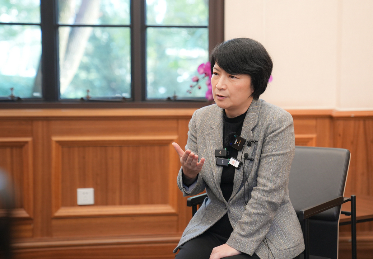
Chen Chunpeng, a doctoral student majoring in Physical Geography, conducts research in the State Key Laboratory of Estuarine and Coastal Research (SKLEC).
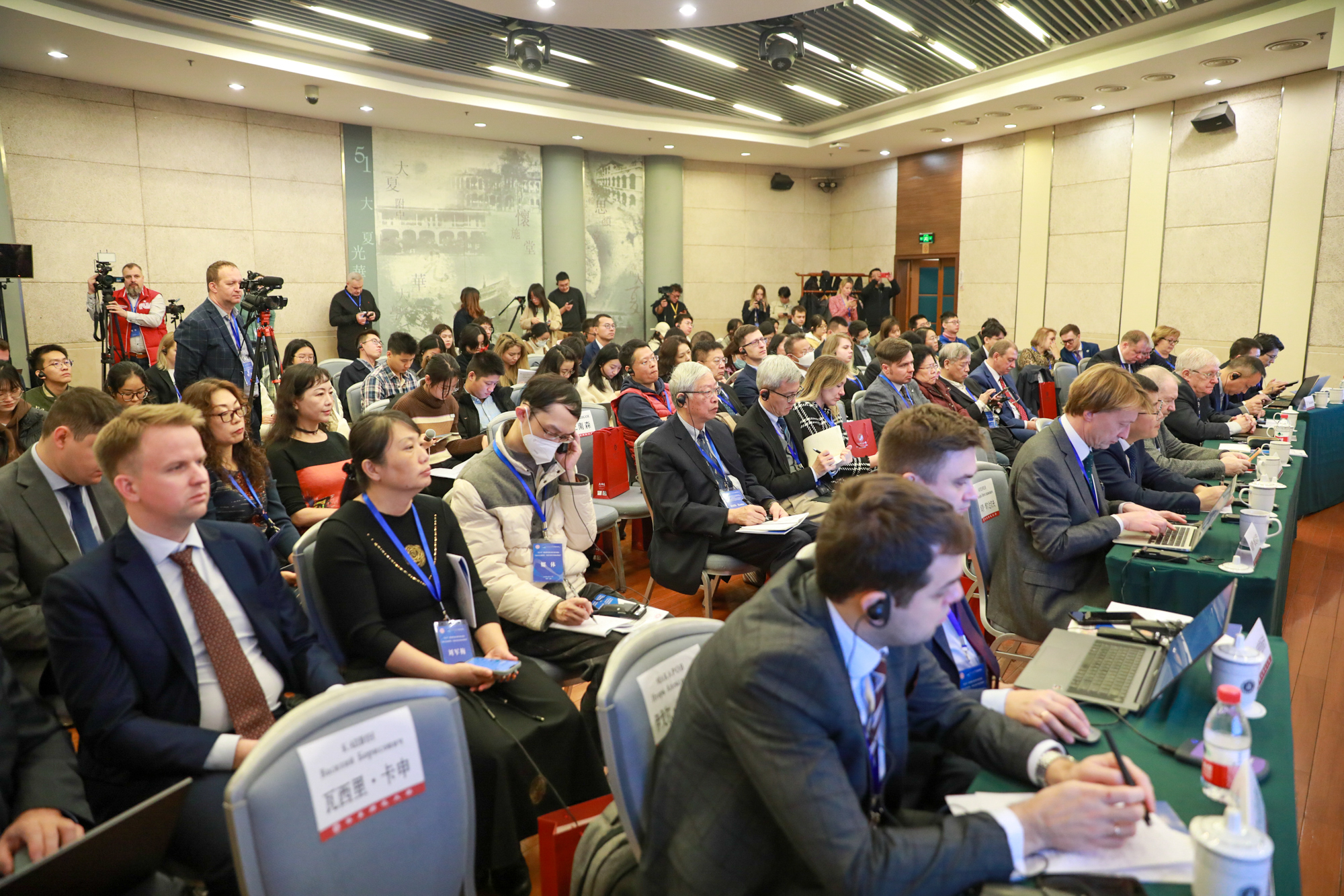
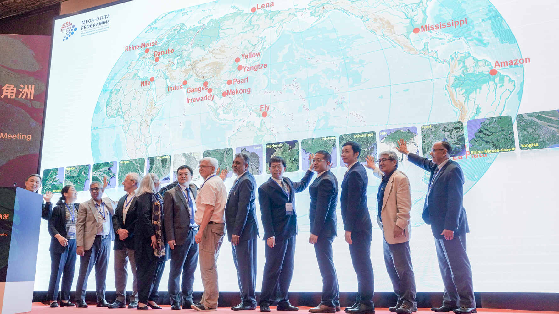
In 2018, Chen was directly admitted to a PhD program by SKLEC of ECNU, specializing in the spatial-temporal intelligent perception of estuarine and coastal remote sensing. In the past five years, he has published 15 SCI papers with a cumulative impact factor of over 110, averaging 7.5 per paper. Among them, he has published 6 SCI papers and 2 EI papers as the first/corresponding author in high-level academic journals such as ISPRS P&RS (IF=12.7) and JoH (IF=6.4), been granted one national invention patent, made oral reports at important international remote sensing conferences such as ISPRS and IEEE IGARSS, and been serving as a reviewer for multiple international SCI journals. In addition, he has participated in multiple scientific research projects, including major projects funded by the National Natural Science Foundation of China and key international science and technology innovation cooperation projects between governments. His research achievements have supported the data acquisition of the “Mega-Delta Programme” of the UN Decade of Ocean Science.
When talking about his most memorable fieldwork experience, Chen recalled, “Together with my teammate Duan Yuanqiang from the research team, we crawled along the mudflat for nearly 1.5 km to measure the spectral data of the mudflat surface and collect gradient samples. When we crawled back, the shore was close at hand but seemed far away. After getting ashore, we were wet through and exhausted.”
According to Chen’s recording, during his doctoral study, he participated in more than 60 coastal zone surveys, covering dozens of estuaries and bays such as the Yellow River Estuary, Jiangsu Coast, Yangtze River Estuary, Hangzhou Bay, the Gulf of Yueqing, Minjiang Estuary, and Beibu Gulf in China.
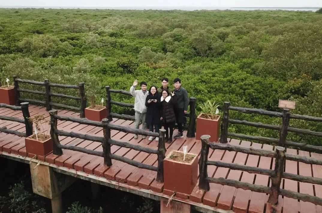
In January 2019, Chen Chunpeng (on the left, waving) and his research team conducted a field survey in the mangrove reserve of Beilun Gulf, Guangxi.
“I still remember when I first entered the SKLEC, I was quite unfamiliar with the terms such as estuaries, deltas, and coasts, and I also had no idea about their significance and the threats they were facing,” said Chen Chunpeng. Through continuous learning and extensive literature reading, Chen Chunpeng gradually learned that 60% of the world’s population and two-thirds of large and medium-sized cities are concentrated in coastal areas. “China is a country with a continental coastline of 18,000 kilometers. In recent decades, under the backdrop of global changes, coastal zone resources, and the environment have undertaken tremendous pressure, and coastal salt marshes, mangroves, and tidal flats have all undergone varying degrees of degradation.”
“That survey allowed us to appreciate the beauty of the mangrove beach and also revealed the encroachment of intensive coastal aquaculture on the mangrove beach.” To understand the distribution and utilization of typical elements such as tidal flats, salt marshes, and mangroves in China’s coastal zone, Chen Chunpeng and his research team, supported by Prof. Zhou Yunxuan and Associate Researcher Tian Bo, traveled to Guangdong and Guangxi in January 2019 respectively to conduct a coastal zone survey.
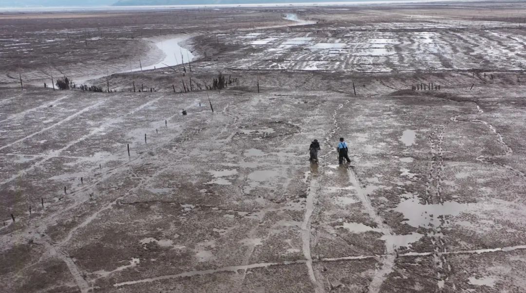
In August 2021, Chen Chunpeng (right) and his teammate Duan Yuanqiang from the research team were sampling on the tidal flat in Cangnan, Wenzhou.
During each winter and summer of his doctoral study, Chen followed the laboratory and research team to conduct coastal zone surveys. Using various techniques and equipment such as multi-spectral RTK drones, lidar, field spectrometers, and multi-parameter water quality detectors, Chen has collected first-hand multi-dimensional information on various factors in China's coastal zone, including terrain, vegetation, and water quality.

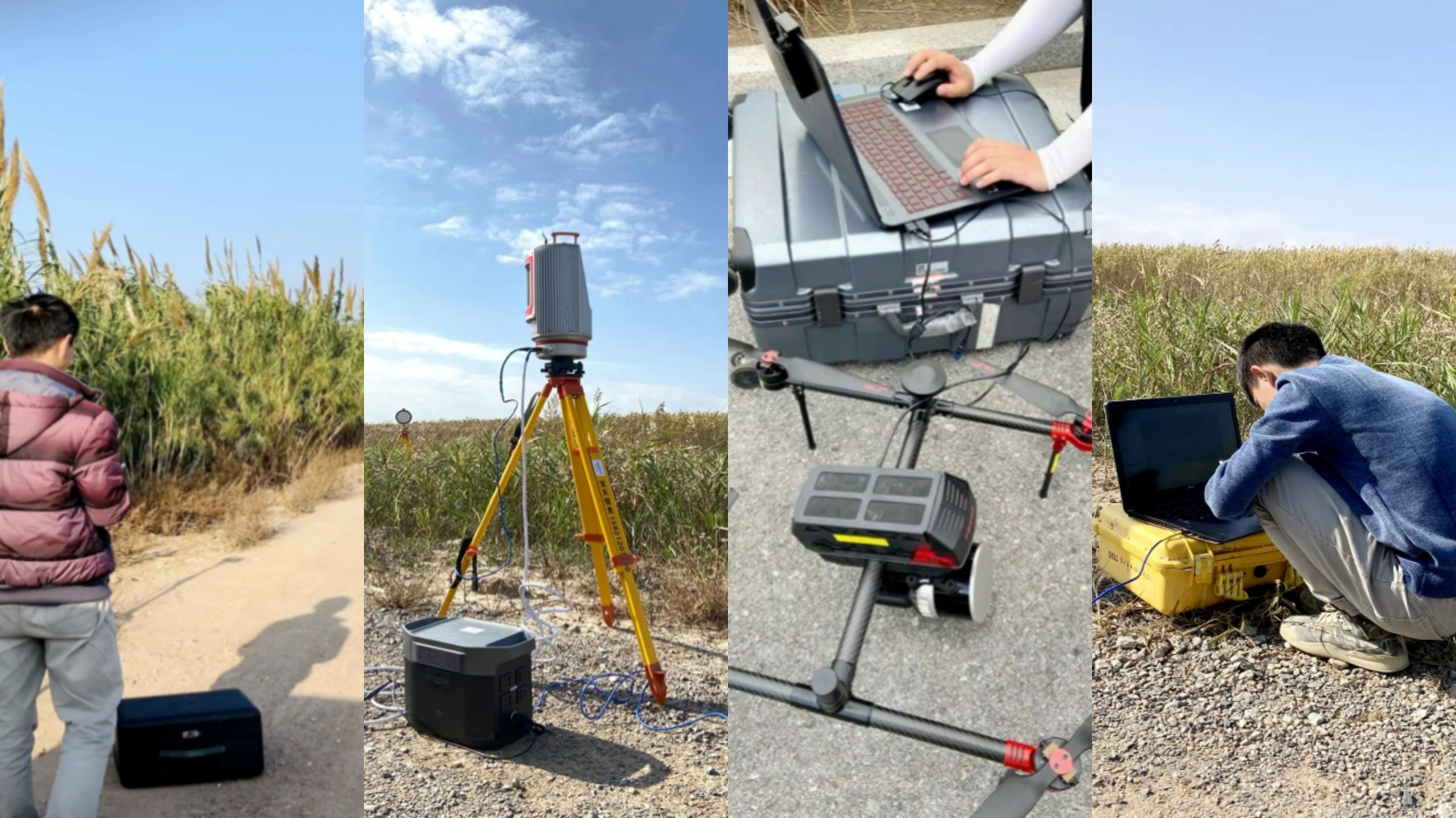
Chen Chunpeng used remote sensing observation techniques such as drone photogrammetry, airborne lidar, and ground-based lidar to obtain three-dimensional information of the coastal zone.
During this process, Chen Chunpeng learned that deep learning technology is the most advanced technical means to process and mine multi-source remote sensing big data. To maximize the use of these hard-earned data, in November 2021, Chen Chunpeng went to Lancaster University in the UK for a two-year joint training funded by the China Scholarship Council, and specifically learned remote sensing AI technology under the guidance of Dr. Zhang Ce, an expert in the field of GeoAI in artificial intelligence.
“The self-collected data and the technology learned during the joint training laid a foundation for me to develop a spatial-temporal intelligent perception model for coastal zone remote sensing.”
In Chen Chunpeng’s opinion, his research topic is “down-to-earth but not simple.” His research aims to accurately and rapidly obtain the geomorphic information of tidal flats.
To this end, he used the technology of “AI-enhanced Temporal Space-Air-Ground Remote Sensing Big Data” to solve the challenges of “large-scale, long-term, high-frequency, and high-precision” observation of coastal tidal flat terrain, transforming the traditional time-consuming, laborious, and dangerous spot measurements via personally beach surveying into remote sensing non-contact areal measurements. His research results have been recognized by experts at home and abroad.
His representative achievements have been published consecutively in the top journal of photogrammetry and remote sensing, ISPRS Journal of Photogrammetry and Remote Sensing, and he has been invited to make oral presentations at international youth forums of multiple universities and important conferences at home and abroad.
Chen Chunpeng posed for a photo after participating in a drone remote sensing application seminar in Qingdao.
Chen Chunpeng made an oral presentation at the International Youth Forum of ECNU.
During his doctoral study, Chen Chunpeng focused on the integration of production and research, striving to promote the practical application of his research achievements. His research work has always revolved around major national and local needs such as “coastal zone protection and restoration,” “Blue Bay Environmental Improvement Initiative,” and “returning farmland to wetlands and returning aquaculture to beaches.” His research achievements have been successfully applied in domestic and international estuarine and coastal areas such as the Yangtze River Delta, the Pearl River Delta, the British coastal zone, and the Irrawaddy River Delta, supporting data acquisition for “Mega–Delta Programme” endorsed by the UN Decade of Ocean Science for Sustainable Development. In addition, he has successfully used his self-developed technical solutions to observe changes in the geomorphic features of tidal flats and assess bird habitats in Shanghai Chongming Dongtan Bird National Nature Reserve for five consecutive years, providing reliable data support for the wetland protection and restoration project in Chongming Dongtan.
After graduation, Chen Chunpeng plans to engage in postdoctoral work to continue exploring and researching intelligent remote sensing of global estuaries and coasts. He stated, “In the future, I will devote myself to the research and development of intelligent remote sensing theories and key technologies for estuaries and coasts, serving the protection and restoration of coastal wetlands, and personally fulfilling the declaration of ‘measuring the beautiful coastline of China with my feet and writing my dissertation on China’s coastline.’”
Copy editor: Philip Nash
Editor: Wicky Xu